Project Description
Warning!
Ridemontaione.com invites you to discover the trails of Montaione accompanied by a local expert guide, a service that you can book by staying at our bike friendly farmhouse Belmonte Vacanze.
Thanks to our local expert guides you can enjoy a cycling adventure in complete safety and without any risk.
The trails described on the site may become impassable due to vegetation or soil erosion, therefore we invite you
not to venture alone on the trails of Montaione without an expert guide.
We invite you not to trust GPS tracks that you can find on the web.
Riding a bicycle in an area that you do not know and on trails that you have never ridden by trusting a GPS track is dangerous.
Ridemontaione is not responsible for accidents that may occur while following the suggested routes.
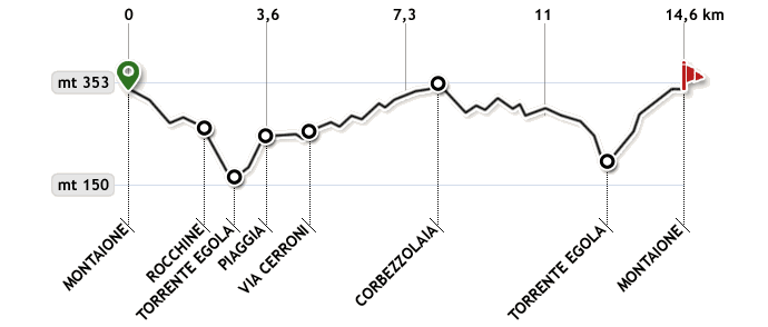
Start from Piazza Gramsci, turning left go up towards the center of Montaione. At the stop sign, turn right towards San Miniato passing in front of the War Memorial of World War II and the panoramic terrace of Montaione from where you can enjoy a magnificent view stretching to the hills around Florence.
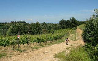
Go down Via Aldo Moro for about 1 km until you see on the left the entrance to the gravel road Via delle Rocche. Here begins a gentle ascent up to a junction where you must keep to the right, then the road starts to descend along a first olive grove (on the right) and then a vineyard (on the left).
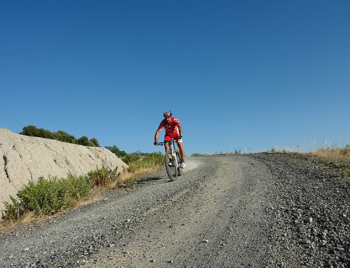
As you go down, approaching the river Egola, the descent becomes steeper and steeper, and the gravel ground will challenge the brakes of your bike and your ability to ride in downhill mountain biking.
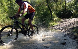
Continuing to go down pass in front of a gate of an old mill, now abandoned by the time of World War II, turn left, and after a short but steep descent you will reach the river Egola. Because there is no bridge over the river Egola, crossing it in Winter or Spring may be challenging due to rising water level.
After crossing the river Egola, it’s time to face the opposite side of the hill in Montaione. Start with a very steep ascent that takes you through a forest, but because of the stony and slippery ground it will make you get down and walk. After about 200 meters, – always paying attention to the white / red signs on the trees that are indicating that you are on the right path – the ascent becomes less challenging therefore allowing you to go back in the saddle of your bike. At this point you’ll be riding alongside a hedge on your left.
Continue to rise until at the top right you will notice the farm buildings of Piaggia, then the road turns right and after a few tens of meters to the left, getting onto an avenue in which the first section skirts a row of cypress trees. Go along this road (Via Piaggia) slightly downhill – that will allow you to catch your breath – up to, after 800 meters, Via Cerroni. Here you turn left on the paved road (Via Cerroni) towards San Vivaldo.
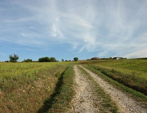
Go along Via Cerroni on a paved road and slightly uphill, where you can see to the right and to the left the typical Tuscan countryside between houses, vineyards, olive groves and rows of cypress trees.
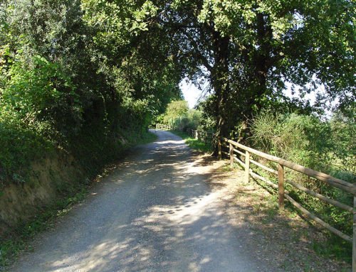
After about 2.5 km the road starts to climb further and enters the woods, where the tops of the trees, touching one another, give you the feeling of going through a tunnel. Then you come out of the woods again, and after about 850 meters, at the top of the slope and close to a wide curve to the right, turn left, take the gravel path leading into the woods. (Localize the path on the left is not very easy, we recommend that you check the odometer or your satellite equipment.)
Continue for about 250 meters on a mostly flat ground, until you reach a widening. Here, take the path down to the left. This single track downhill has a large step after 150 meters, where the most daring riders, travelling at full speed, may take a leap of a few meters.
After 130 meters, near a junction in the road, the trail turns right and passes through a tunnel made from Arbutus plants (a typical shrub of the Mediterranean scrub and whose fruit, which is harvested during Fall consists of a yellow or red berry, is used to make jams) that give the name to this location: “Corbezzolaia”.
Continue for another 60 meters until you come to another junction – recognizable by an oak tree in the middle of the branching paths – where you take the road on the left.
Continue downhill for 130 meters. Then, following the main path, you will curve to the left near another path which instead continues to the right. Continue down for about 300 meters on a ground particularly eroded by rain and that will test your quality of acrobat.
Continue upwards and downwards into the woods where at this point the plants of Arbutus leave space for the tall trees of chestnut. The last ascent in this section of the woods is a bit more challenging and will force you to put the lower gears until you reach the paved road (Via Cerroni).
Turn right and ride on a paved road for about 100 meters and then take the woods again onto the gravel road on the left.
At one point of the descent – after about 240 meters from the paved road-even if the instinct will be to continue to go down, you must be careful to take the path on the right. This point is recognizable because on the left side of the path there are some signs that indicate the names of the trails. Then turn right and follow the sign for the path “Ameno”.
Here start a pleasant trail with gentle ups and downs within the dense vegetation that will protect you from the hottest Summer days.
After a few hundred meters the road narrows to a single track until you arrive – after less than a km – again on the paved road where you turn left. (Via Cerroni)
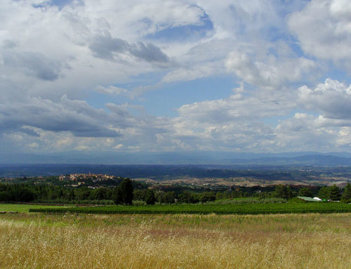
After 200 meters, you leave the paved road and turn right. Before you begin the descent, stop to admire the beauty of the Tuscan countryside and the village of Montaione, which stands in front of you on the top of a hill. Throw yourself down at full speed along the foot of a vineyard and then re-enter the woods taking, at the first junction – recognizable by some cypress trees on the left – the road to the left. Here you should slow down because it begins a steep and technical descent on a slippery ground that, after about 600 meters, will take you to pass in front of a house.
Continue to go down for another 130 meters until you pass the small bridge over the river Egola. From here begins a very steep ascent on the paved road, which after 1 km and 150 meters will take you to Viale Matteotti in Montaione. Go along Viale Matteotti uphill to the crossroads with Viale Italia and from there, along the ancient walls of the castle of Montaione you will arrive at Piazza Cavour. Then turn right onto Viale Filicaja and after 100 meters turn left until you get back to the starting point in Piazza Gramsci.
